Αρχείο:Britannica Mantineia.jpg

Εικόνα σε υψηλότερη ανάλυση (1.475 × 1.101 εικονοστοιχεία, μέγεθος αρχείου: 456 KB, τύπος MIME: image/jpeg)
|
|
Αυτό το αρχείο και η περιγραφή του προέρχονται από το Wikimedia Commons. Οι πληροφορίες από την σελίδα περιγραφής του εκεί εμφανίζονται παρακάτω. |
Σύνοψη
| Περιγραφή |
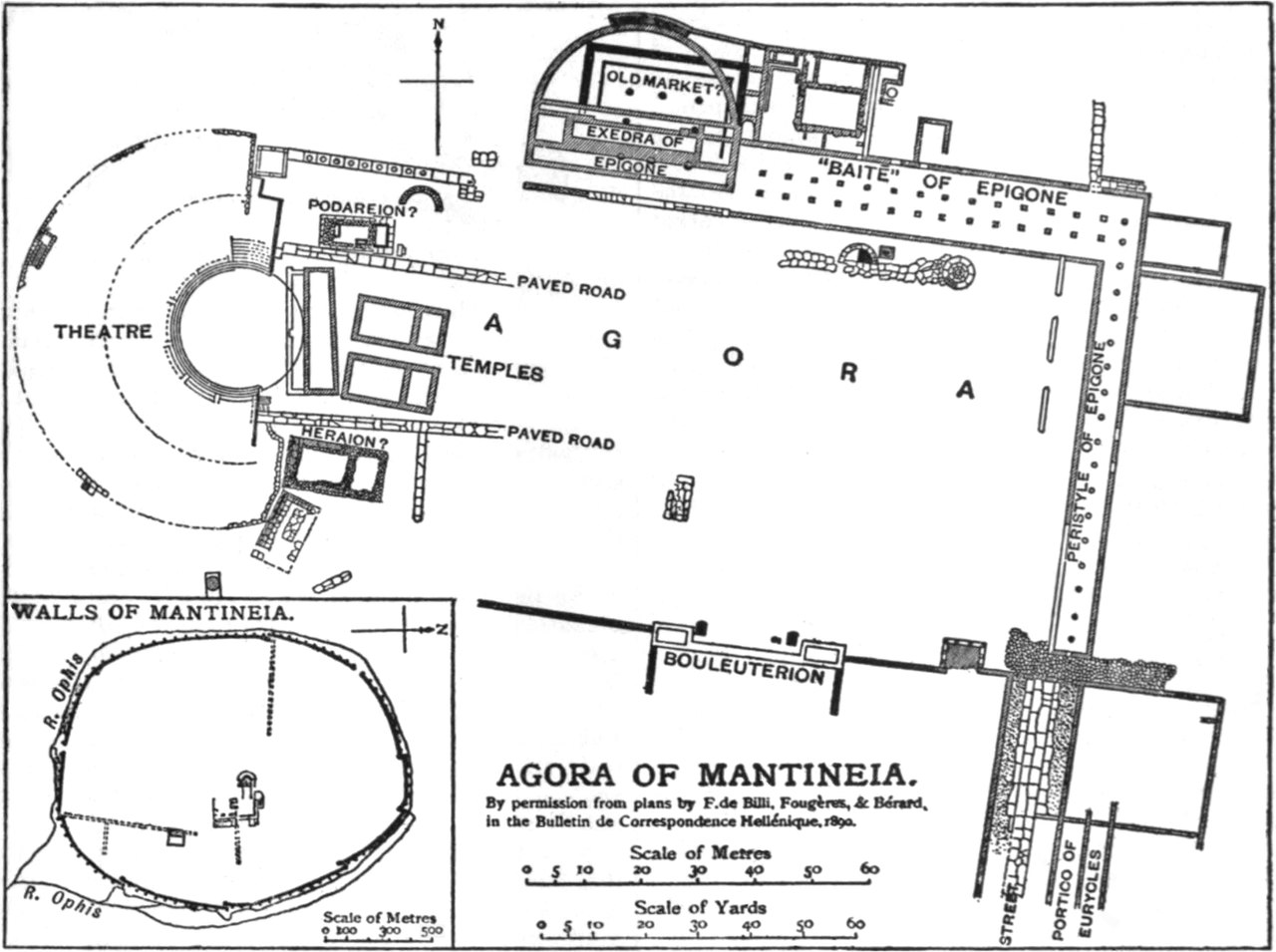
English: Map of the excavation of the Greek city of Mantinea. |
|||
| Ημερομηνία | 1890; published 1911 | |||
| Πηγή | Encyclopædia Britannica (11th ed.), v. 17, 1911, p. 605. | |||
| Δημιουργός | Ernest Arthur Gardner wrote the article; Walker and Cockerell engraved the illustration. | |||
| Άδεια (Επαναχρησιμοποίηση αυτού του αρχείου) |
|

| Object location | | View this and other nearby images on: OpenStreetMap |
|---|
| Camera location | | View this and other nearby images on: OpenStreetMap |
|---|
Αδειοδότηση
|
Αυτό το έργο είναι κοινό κτήμα στη χώρα προέλευσής του και άλλες χώρες και περιοχές όπου η διάρκεια πνευματικών δικαιωμάτων είναι όσο η ζωή του δημιουργού και μέχρι 70 χρόνια μετά ή λιγότερο.
| |
| Αυτό το αρχείο έχει χαρακτηριστεί ως απαλλαγμένο από γνωστούς περιορισμούς βάσει της νομοθεσίας περί πνευματικής ιδιοκτησίας, περιλαμβανομένων όλων των συναφών και συγγενικών δικαιωμάτων. | |
Ιστορικό αρχείου
Κλικάρετε σε μια ημερομηνία/ώρα για να δείτε το αρχείο όπως εμφανιζόταν εκείνη τη στιγμή.
| Ώρα/Ημερομ. | Μικρογραφία | Διαστάσεις | Χρήστης | Σχόλια | |
|---|---|---|---|---|---|
| τελευταία | 23:58, 14 Ιανουαρίου 2021 | | 1.475 × 1.101 (456 KB) | DivermanAU | Black and white; improve contrast |
| 21:58, 30 Οκτωβρίου 2014 |  | 1.475 × 1.101 (382 KB) | Library Guy | better reproduction and clipping | |
| 16:44, 20 Ιανουαρίου 2009 |  | 736 × 558 (97 KB) | Bob Burkhardt | {{Information |Description={{en|1=Map of the excavation of the Greek city of Mantinea from 1911 Encyclopædia Britannica, Vol. 17, p. 605.}} |Source=1911 Encyclopædia Britannica |Author=undicipherable |Date=1890; published 1911 |Permission= |other_versio |
Συνδέσεις αρχείου
Τα παρακάτω λήμματα συνδέουν σε αυτό το αρχείο:
Καθολική χρήση αρχείου
Τα ακόλουθα άλλα wiki χρησιμοποιούν αυτό το αρχείο:
- Χρήση σε en.wikisource.org
- Χρήση σε fi.wikipedia.org