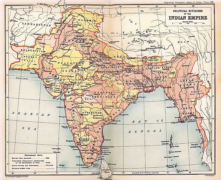
Αρχείο:British Indian Empire 1909 Imperial Gazetteer of India.jpg

Μέγεθος αυτής της προεπισκόπησης: 734 × 599 εικονοστοιχεία . Άλλες αναλύσεις: 294 × 240 εικονοστοιχεία | 588 × 480 εικονοστοιχεία | 941 × 768 εικονοστοιχεία | 1.254 × 1.024 εικονοστοιχεία | 1.498 × 1.223 εικονοστοιχεία.
Εικόνα σε υψηλότερη ανάλυση (1.498 × 1.223 εικονοστοιχεία, μέγεθος αρχείου: 957 KB, τύπος MIME: image/jpeg)
Ιστορικό αρχείου
Κλικάρετε σε μια ημερομηνία/ώρα για να δείτε το αρχείο όπως εμφανιζόταν εκείνη τη στιγμή.
| Ώρα/Ημερομ. | Μικρογραφία | Διαστάσεις | Χρήστης | Σχόλια | |
|---|---|---|---|---|---|
| τελευταία | 20:26, 15 Μαρτίου 2012 |  | 1.498 × 1.223 (957 KB) | Soerfm | Color |
| 20:28, 15 Μαρτίου 2012 |  | 1.498 × 1.223 (1,53 MB) | Soerfm | Color | |
| 22:55, 8 Φεβρουαρίου 2012 |  | 1.498 × 1.223 (957 KB) | M0tty | Remove compression artefacts by a bilateral filtering. | |
| 16:33, 23 Μαΐου 2010 |  | 1.498 × 1.223 (694 KB) | Malus Catulus | removed watermark | |
| 23:13, 24 Ιουλίου 2009 |  | 1.498 × 1.223 (457 KB) | BetacommandBot | move approved by: User:Kintetsubuffalo This image was moved from File:IGI british indian empire1909reduced.jpg {{BotMoveToCommons|en.wikipedia|year=2008|month=October |day=13}} {{Information |Description={{en|Image of map of the British Indian |
Συνδέσεις αρχείου
Τα παρακάτω λήμματα συνδέουν σε αυτό το αρχείο:
Καθολική χρήση αρχείου
Τα ακόλουθα άλλα wiki χρησιμοποιούν αυτό το αρχείο:
- Χρήση σε af.wikipedia.org
- Χρήση σε ar.wikipedia.org
- Χρήση σε arz.wikipedia.org
- Χρήση σε ast.wikipedia.org
- Χρήση σε as.wikipedia.org
- Χρήση σε azb.wikipedia.org
- Χρήση σε az.wikipedia.org
- Χρήση σε ba.wikipedia.org
- Χρήση σε be-tarask.wikipedia.org
- Χρήση σε be.wikipedia.org
- Χρήση σε bg.wikipedia.org
- Χρήση σε bh.wikipedia.org
- Χρήση σε bn.wikipedia.org
- Χρήση σε ca.wikipedia.org
- Χρήση σε ce.wikipedia.org
- Χρήση σε ckb.wikipedia.org
- Χρήση σε cs.wikipedia.org
- Χρήση σε cy.wikipedia.org
- Χρήση σε da.wikipedia.org
- Χρήση σε de.wikipedia.org
Δείτε περισσότερη καθολική χρήση αυτού του αρχείου.
