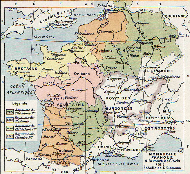
Αρχείο:Division of Gaul - 511.jpg

Μέγεθος αυτής της προεπισκόπησης: 655 × 600 εικονοστοιχεία . Άλλες αναλύσεις: 262 × 240 εικονοστοιχεία | 524 × 480 εικονοστοιχεία | 839 × 768 εικονοστοιχεία | 1.241 × 1.136 εικονοστοιχεία.
Εικόνα σε υψηλότερη ανάλυση (1.241 × 1.136 εικονοστοιχεία, μέγεθος αρχείου: 346 KB, τύπος MIME: image/jpeg)
Ιστορικό αρχείου
Κλικάρετε σε μια ημερομηνία/ώρα για να δείτε το αρχείο όπως εμφανιζόταν εκείνη τη στιγμή.
| Ώρα/Ημερομ. | Μικρογραφία | Διαστάσεις | Χρήστης | Σχόλια | |
|---|---|---|---|---|---|
| τελευταία | 08:26, 3 Ιανουαρίου 2008 |  | 1.241 × 1.136 (346 KB) | Laurens~commonswiki | {{Information |Description={{en|The map comes from Vidal-Lablache, ''Atlas général d'histoire et de géographie'' (1894).}} |Source=Transfered from [http://en.wikipedia.org en.wikipedia] Transfer was stated to be made by User:laurens. |Date=2007-08- |
Συνδέσεις αρχείου
Τα παρακάτω λήμματα συνδέουν σε αυτό το αρχείο:
Καθολική χρήση αρχείου
Τα ακόλουθα άλλα wiki χρησιμοποιούν αυτό το αρχείο:
- Χρήση σε af.wikipedia.org
- Χρήση σε arz.wikipedia.org
- Χρήση σε azb.wikipedia.org
- Χρήση σε be.wikipedia.org
- Χρήση σε bg.wikipedia.org
- Χρήση σε ca.wikipedia.org
- Χρήση σε cs.wikipedia.org
- Χρήση σε de.wikipedia.org
- Χρήση σε en.wikipedia.org
- Χρήση σε fa.wikipedia.org
- Χρήση σε fi.wikipedia.org
- Χρήση σε fr.wikipedia.org
- Χρήση σε gl.wikipedia.org
- Χρήση σε hr.wikipedia.org
- Χρήση σε hy.wikipedia.org
- Χρήση σε id.wikipedia.org
- Χρήση σε it.wikipedia.org
- Χρήση σε ja.wikipedia.org
- Χρήση σε ko.wikipedia.org
- Χρήση σε mk.wikipedia.org
- Χρήση σε pl.wikipedia.org
- Χρήση σε ru.wikipedia.org
- Χρήση σε sh.wikipedia.org
- Χρήση σε sl.wikipedia.org
Δείτε περισσότερη καθολική χρήση αυτού του αρχείου.

