Αρχείο:Balkan peninsula line.jpg
Δεν διατίθεται υψηλότερη ανάλυση.
Balkan_peninsula_line.jpg (558 × 530 εικονοστοιχεία, μέγεθος αρχείου: 169 KB, τύπος MIME: image/jpeg)
|
|
Αυτό το αρχείο και η περιγραφή του προέρχονται από το Wikimedia Commons. Οι πληροφορίες από την σελίδα περιγραφής του εκεί εμφανίζονται παρακάτω. |
Σύνοψη
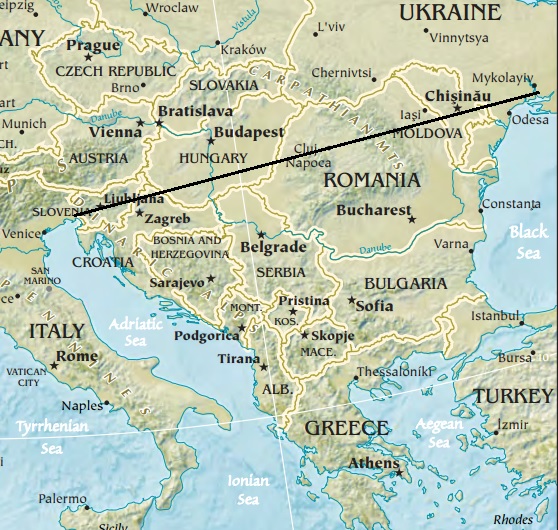
| Περιγραφή | Map of the Balkan peninsula, showing the line stretching from the northernmost point of the Adriatic to the northernmost point of the Black Sea. Made from Europe map at The Central Intelligence Agency World Factbook, which is in the public domain. |
| Πηγή | https://www.cia.gov/library/publications/the-world-factbook//graphics/ref_maps/physical/jpg/europe.jpg |
| Δημιουργός | CIA |
| άλλες εκδόσεις |
|
.jpg)
Αδειοδότηση
This image is in the public domain because it contains materials that originally came from the United States Central Intelligence Agency's World Factbook.
|
 |

|
This map image could be re-created using vector graphics as an SVG file. This has several advantages; see Commons:Media for cleanup for more information. If an SVG form of this image is available, please upload it and afterwards replace this template with
{{vector version available|new image name}}.
It is recommended to name the SVG file “Balkan peninsula line.svg”—then the template Vector version available (or Vva) does not need the new image name parameter. |


Ιστορικό αρχείου
Κλικάρετε σε μια ημερομηνία/ώρα για να δείτε το αρχείο όπως εμφανιζόταν εκείνη τη στιγμή.
| Ώρα/Ημερομ. | Μικρογραφία | Διαστάσεις | Χρήστης | Σχόλια | |
|---|---|---|---|---|---|
| τελευταία | 12:27, 16 Ιανουαρίου 2014 | | 558 × 530 (169 KB) | Denniss | Reverted to version as of 22:51, 26 December 2013 |
| 21:21, 15 Ιανουαρίου 2014 |  | 348 × 382 (43 KB) | Ivan VA | stop vandalizing maps | |
| 22:51, 26 Δεκεμβρίου 2013 |  | 558 × 530 (169 KB) | No More Cats | Please don't revert to outdated versions of maps | |
| 22:43, 26 Δεκεμβρίου 2013 |  | 348 × 382 (43 KB) | Nikola Smolenski | Reverted to version as of 19:13, 3 November 2006 | |
| 16:06, 17 Δεκεμβρίου 2013 |  | 558 × 530 (169 KB) | No More Cats | Map of the Balkan peninsula, showing the line stretching from the northernmost point of the Adriatic to the northernmost point of the Black Sea. Made from most recent map at [https://www.cia.gov/cia/publications/factbook/reference_maps/jpg/europe.jpg]. | |
| 19:13, 3 Νοεμβρίου 2006 |  | 348 × 382 (43 KB) | Nikola Smolenski | Map of the Balkan peninsula, showing the line stretching from the northernmost point of the Adriatic to the northernmost point of the Black Sea. Made from map at [https://www.cia.gov/cia/publications/factbook/reference_maps/jpg/europe.jpg]. |
Συνδέσεις αρχείου
Δεν υπάρχουν σελίδες που συνδέουν σε αυτό το αρχείο.