Αρχείο:Lake Pontchartrain Causeway south.jpg
Μέγεθος αυτής της προεπισκόπησης: 800 × 534 εικονοστοιχεία . Άλλες αναλύσεις: 320 × 214 εικονοστοιχεία | 640 × 427 εικονοστοιχεία | 1.024 × 683 εικονοστοιχεία | 1.500 × 1.001 εικονοστοιχεία.
Εικόνα σε υψηλότερη ανάλυση (1.500 × 1.001 εικονοστοιχεία, μέγεθος αρχείου: 281 KB, τύπος MIME: image/jpeg)
|
|
Αυτό το αρχείο και η περιγραφή του προέρχονται από το Wikimedia Commons. Οι πληροφορίες από την σελίδα περιγραφής του εκεί εμφανίζονται παρακάτω. |
| Περιγραφή |
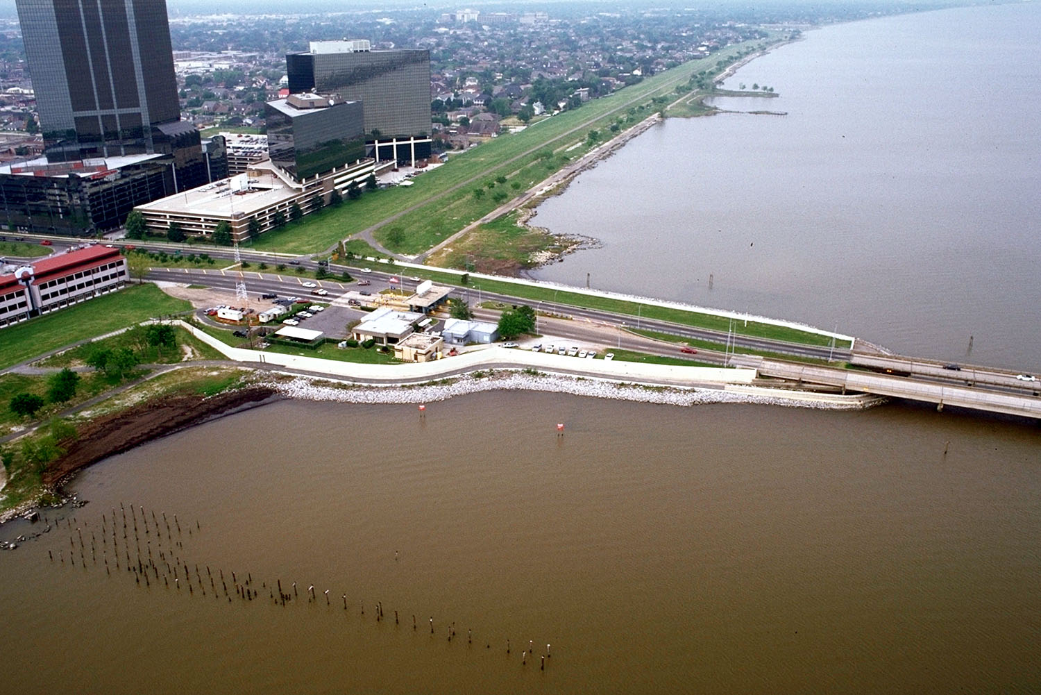
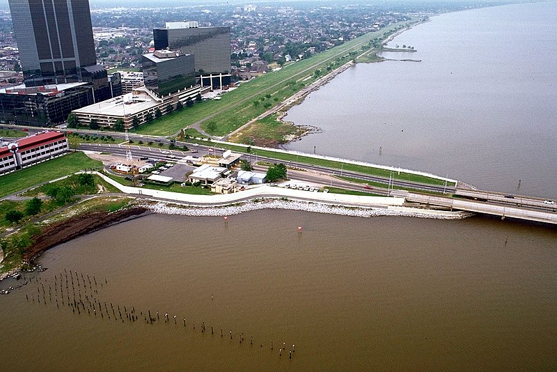
English: The southern end of the Lake Pontchartrain Causeway at Metairie, Louisiana, USA. View is to the southwest near Causeway Boulevard, Metairie. |
|||
| Ημερομηνία | ||||
| Πηγή |
U.S. Army Corps of Engineers Digital Visual Library Image page Image description page Digital Visual Library home page |
|||
| Δημιουργός | Arthur Belala, U.S. Army Corps of Engineers | |||
| Άδεια (Επαναχρησιμοποίηση αυτού του αρχείου) |
|
|||
| Location | New Orleans, Louisiana, USA |
| Camera location | | View this and other nearby images on: OpenStreetMap |
|---|
Ιστορικό αρχείου
Κλικάρετε σε μια ημερομηνία/ώρα για να δείτε το αρχείο όπως εμφανιζόταν εκείνη τη στιγμή.
| Ώρα/Ημερομ. | Μικρογραφία | Διαστάσεις | Χρήστης | Σχόλια | |
|---|---|---|---|---|---|
| τελευταία | 16:59, 1 Απριλίου 2007 | | 1.500 × 1.001 (281 KB) | DanMS | {{Information | Description = {{en|The southern end of the Lake Pontchartrain Causeway at New Orleans, Louisiana, USA. View is to the southwest over New Orleans.}} | Source = U.S. Army Corps of Engineers Digital Visual Library<br />[http://imag |
Συνδέσεις αρχείου
Τα παρακάτω λήμματα συνδέουν σε αυτό το αρχείο:
Καθολική χρήση αρχείου
Τα ακόλουθα άλλα wiki χρησιμοποιούν αυτό το αρχείο:
- Χρήση σε ar.wikipedia.org
- Χρήση σε cs.wikipedia.org
- Χρήση σε en.wikipedia.org
- Χρήση σε es.wikipedia.org
- Χρήση σε fa.wikipedia.org
- Χρήση σε fi.wikipedia.org
- Χρήση σε fr.wikipedia.org
- Χρήση σε id.wikipedia.org
- Χρήση σε it.wikipedia.org
- Χρήση σε nl.wikipedia.org
- Χρήση σε pl.wikipedia.org
- Χρήση σε pt.wikipedia.org
- Χρήση σε sk.wikipedia.org
- Χρήση σε sr.wikipedia.org
- Χρήση σε sw.wikipedia.org
- Χρήση σε tr.wikipedia.org
- Χρήση σε uk.wikipedia.org
- Χρήση σε uz.wikipedia.org
- Χρήση σε vi.wikipedia.org
- Χρήση σε zh-yue.wikipedia.org